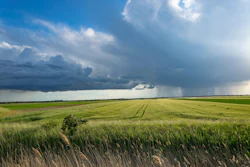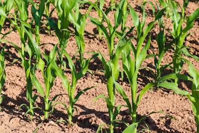
Drought conditions deteriorated across the Midwest and High Plains during the past week as above-normal temperatures and precipitation shortfalls led to expansion and intensification of dry conditions, according to the latest U.S. Drought Monitor. The U.S. Drought Monitor is produced by the National Drought Mitigation Center at the University of Nebraska-Lincoln, the U.S. Department of Agriculture, the National Oceanic and Atmospheric Administration and NASA.
The rapidly worsening situation prompted South Dakota’s governor to issue a drought emergency executive order last week. Temperatures across the Dakotas and Nebraska ranged from 4 to 10 degrees above normal, while reports of poor rangeland conditions mounted throughout the region.
High Plains faces rapid deterioration
Drought-related conditions worsened across the High Plains, including the Dakotas and Nebraska, with reports of rapidly deteriorating conditions throughout the region. The National Drought Mitigation Center’s Condition Monitoring Observer Report drought impacts reporting system showed numerous impact reports across the Dakotas during the past 30 days.
Several locations logged near-record dryness for the past 30-day period. Omaha, Nebraska, recorded its third driest conditions on record with a 3.16-inch departure from normal. Grand Island, Nebraska, saw its fifth driest period with a 3.05-inch departure, while Rapid City’s National Weather Service Weather Forecast Office in South Dakota recorded its fifth driest conditions with a 1.48-inch departure.
Upper Midwest sees expanding dry conditions
Degradations occurred across areas of Minnesota, Iowa, Wisconsin and Michigan in response to above-normal temperatures and precipitation shortfalls during the past 30-day period. Temperatures in the northern extent of the region logged anomalies ranging from 2 to 6 degrees above normal, while the southern tier experienced near-normal temperatures.
The situation contrasted sharply with conditions in Kentucky, where precipitation has been well above normal during the past month, leading to continued improvements. Several locations in the southern Midwest ranked among their wettest or near-wettest on record for the past 30-day period. Paducah, Kentucky, recorded its wettest conditions on record with a 7.09-inch departure from normal, while Louisville International Airport also logged its wettest period on record with a 7.08-inch departure. Ames Municipal Airport recorded its second wettest period with a 7.77-inch departure, and Evansville, Indiana, saw its fifth wettest conditions with a 4.37-inch departure.
Outlook calls for continued warmth
The National Weather Service 6-10 day temperature outlook for July 27-31 favors above-normal temperatures across most of the contiguous United States, with the highest probabilities centered across the Plains states and western portions of the Midwest. The precipitation outlook favors below-normal precipitation across eastern portions of the central and southern Plains and the Midwest, suggesting conditions may continue to worsen in drought-affected areas.