The weekly drought monitor report showed that the central and southern United States experienced an unprecedented heat dome over the holiday week, shattering daily high-temperature records with readings soaring 15 to 35 degrees above average between December 24 and 27. This extreme warmth culminated in what was forecast to be the warmest Christmas Day on record for the contiguous U.S. However, this pattern ended abruptly as a powerful winter cyclone swept eastward from the Plains between December 27 and 29. The storm drove a sharp cold front through the South, causing temperatures to plunge from record highs to near freezing overnight. The U.S. Drought Monitor is jointly produced by the National Drought Mitigation Center at the University of Nebraska-Lincoln, the United States Department of Agriculture and the National Oceanic and Atmospheric Administration.
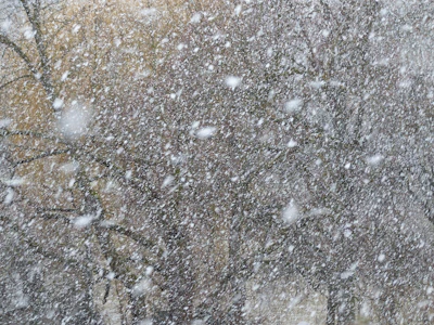
The winter system unleashed blizzard conditions and up to two feet of snow near Lake Superior, along with significant ice accumulations that disrupted travel in parts of the Northeast. While much of the country saw near- to below-normal precipitation, the West Coast was an exception. A strong atmospheric river delivered heavy rainfall to California, with some areas receiving over 10 inches of rain and several feet of new mountain snow.
In the Northeast, rainfall totaling 2 to 3 inches in parts of New York, Maine, Pennsylvania, and West Virginia helped reduce severe drought conditions in some areas. Yet, below-normal precipitation expanded drought in Massachusetts, Maryland, and Delaware. The Southeast faced mostly dry conditions and above-normal temperatures, worsening moderate to severe drought in Alabama, Florida, Georgia, and the Carolinas.
The South saw widespread drought degradation, with extreme drought expanding in central Texas and severe drought spreading across parts of Oklahoma, Louisiana, Tennessee, and Arkansas. The Midwest experienced mixed conditions: above-normal precipitation improved drought in northern areas, but southern Missouri and southern Illinois saw drought expand due to dry weather.
The High Plains remained warm and mostly dry, with extreme drought growing in central Colorado and moderate drought expanding in parts of Nebraska and Kansas. Beneficial precipitation in western Wyoming eased drought there.
The West showed improvements in drought conditions due to recent heavy precipitation, especially in Washington, Idaho, Montana, Nevada, and Arizona. However, drought worsened in western Utah and central Nevada.
In the Caribbean, scattered showers improved dryness in some areas but drought expanded in others, including parts of the U.S. Virgin Islands.
Looking ahead, a split weather pattern will bring cold, snowy conditions to the eastern U.S. and continued warmth in the West. Heavy precipitation is expected to return to California and the Sierra Nevada, while below-average temperatures will dominate the Upper Midwest and Northeast. The Climate Prediction Center forecasts above-normal precipitation for Hawaii, the Pacific Coast, Alaska, and parts of the northern Plains and New England, with warmer-than-average temperatures across much of the country except Alaska and the Northeast.