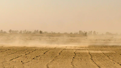
Drought worsened from the Mississippi River Valley to the Southeast and mid-Atlantic during the week ended Tuesday, while heavy rain brought more improvement to Texas and the Southwest, according to the U.S. Drought Monitor . The U.S. Drought Monitor is produced by the National Drought Mitigation Center at the University of Nebraska-Lincoln, the U.S. Department of Agriculture, the National Oceanic and Atmospheric Administration and NASA.
The sharpest deterioration was in Arkansas, Louisiana and Mississippi, where exceptional drought, the most intense category on the map, continued to spread. Mississippi saw a large expansion across the central part of the state as precipitation deficits going back more than a year kept growing.
The scale of the deficit is the key number. Many parts of the three states need at least 20 to 30 inches of rain within three months to overcome current conditions, the report said.
Texas moved the other way. Rainfall of 3 to 4 inches or more fell along the Gulf Coast between Corpus Christi and the Houston area, easing severe to extreme drought in southeastern Texas. One to 2 inches of rain also relieved drought in central Oklahoma.
In the Midwest, abnormal dryness and drought kept expanding across southern and central Missouri into Illinois because of scant rainfall, and abnormal dryness was introduced in southeastern Wisconsin. The northern part of the region was unchanged.
The Southeast received virtually no precipitation, and conditions worsened almost everywhere from Alabama through Virginia. Extreme drought intensified in the Piedmont and eastern parts of South Carolina and North Carolina into southern Virginia.
Changes in the High Plains were limited, with small degradations in eastern Kansas and the northern Colorado Rockies. The exception was Wyoming, where well-above-average temperatures and a lack of precipitation expanded extreme drought in the north and led to the introduction of exceptional drought in the northeast.
In the West, storms brought heavy precipitation to coastal Washington, Oregon and northwestern California, and improvement spread across southeastern California, southeastern Nevada, northern Arizona, southern and eastern Utah, and New Mexico. Moderate drought was introduced in parts of northwestern Montana and northern Idaho, where temperatures ran 10 degrees or more above average.
Looking ahead, the report said a storm forming along Florida's east coast could spread rain into the Carolinas and mid-Atlantic, and a powerful system is expected to bring several inches of precipitation to California and 50 to 100 inches of snow to the Sierra Nevada. The Climate Prediction Center's six- to 10-day outlook calls for above-normal precipitation across much of the West, South and East, and above-normal temperatures for most of the country except Texas.