The latest U.S. Drought Monitor report reveals significant improvements in Texas contrasting sharply with worsening conditions in the Pacific Northwest. The U.S. Drought Monitor is jointly produced by the National Drought Mitigation Center at the University of Nebraska-Lincoln, the United States Department of Agriculture, and the National Oceanic and Atmospheric Administration.
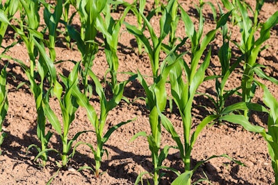
Heavy rainfall in the first week of July brought substantial relief to drought-stricken areas of Texas, particularly the Edwards Plateau and south-central regions. Some areas received between 12 to 18 inches of precipitation, leading to a broad one to two-category improvement in drought status. However, the report cautions that long-term drought persists in many areas due to multiple years of dry conditions affecting groundwater and reservoir levels.
"Although 1 to 2-category improvements were made, a long-term drought dating back multiple years with low groundwater and reservoir levels continue," the report states. The Edwards Aquifer Authority's long-term observation wells in Medina and Uvalde counties remain at extreme to exceptional drought levels.
In stark contrast, the Pacific Northwest saw a rapid decline in soil moisture and low 28-day average streamflows, prompting an expansion of moderate to severe drought across Oregon and Washington. Northern Idaho experienced an expansion of extreme drought conditions.
The report also highlights other regional trends:
The Midwest saw mixed conditions, with worsening drought in northern Illinois due to increasing precipitation deficits and above-normal temperatures. Parts of Indiana, western Ohio, northwestern Kentucky, and northwestern Missouri also experienced minor degradations.
The Northeast remains largely drought-free, with only small areas of long-term drought in northeastern Maryland and southeastern Massachusetts.
Florida saw improvements in drought conditions across much of the central to southwestern peninsula due to heavy rainfall, though some areas along the Atlantic coast and south of Lake Okeechobee continue to experience varying levels of drought.
The High Plains region experienced improvements in parts of the Dakotas, Nebraska, eastern Colorado, and eastern Wyoming due to above-average precipitation over the past 90 days.
In the West, abnormally dry conditions expanded across northern to central California, while parts of Arizona saw a small reduction in extreme drought due to monsoon showers.
Looking ahead, the Climate Prediction Center's 6-10 day outlook favors above-normal precipitation across the eastern two-thirds of the contiguous U.S., with the largest probabilities forecast for the Florida Panhandle, western Texas, and eastern New Mexico. The Pacific Northwest is expected to see below-normal precipitation.
Temperature forecasts indicate above-normal conditions for the Pacific Northwest, Great Basin, eastern Texas, Lower Mississippi Valley, and the East, while the Great Plains may experience below-normal temperatures.
As drought conditions continue to evolve, agricultural and water management officials will be closely monitoring these trends to inform resource allocation and conservation efforts in the coming weeks and months.