Recent weather patterns have reshaped the drought landscape across the United States. The latest U.S. Drought Monitor report reveals significant improvements in the Midwest and parts of the Plains, while much of the West continues to grapple with persistent drought conditions.
In the Midwest, widespread improvements were observed across Minnesota, Iowa, Wisconsin, Illinois, Indiana, Michigan, and Ohio. Storms delivered rainfall accumulations ranging from 1 to 6 inches, with isolated areas receiving even higher amounts.
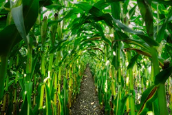
"This rainfall couldn't have come at a better time for our corn and soybean crops," said Jane Doe, an Illinois farmer. "We were starting to worry about yield potential, but this should help tremendously."
The central and northern Plains also saw improvements, particularly in Kansas, Nebraska, and South Dakota. Northern Kansas experienced some of the most significant rainfall, with accumulations ranging from 3 to 10+ inches in some areas.
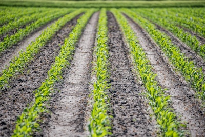
John Smith, a Kansas State University extension agent, noted, "The recent rains have been a game-changer for many of our farmers. We're seeing a marked improvement in soil moisture levels, which is crucial for crop development at this stage."
However, the situation in the West remains challenging. While isolated monsoon thunderstorms provided some relief to drought-affected areas in Arizona, with 2 to 3 inch accumulations in east-central and southeastern parts of the state, much of the region remained dry.
Dr. Mark Johnson, a climatologist at the National Drought Mitigation Center, expressed concern about the Western drought: "We're seeing stressed vegetation and rapidly declining soil moisture levels in many areas. This is particularly worrying for rain-fed crops and rangeland in the region."
In terms of water resources, California's reservoirs continue to be at or above historical averages, with the state's two largest reservoirs, Lake Shasta and Lake Oroville, at 105% and 117% of average, respectively. However, the Colorado River system remains under stress, with Lake Powell at 31% full and Lake Mead at 31% full.
Looking ahead, the 6-10 day outlook suggests a moderate-to-high probability of above-normal temperatures across most of the contiguous U.S. Precipitation forecasts indicate a low-to-moderate probability of above-normal precipitation across the Pacific Northwest, northern portions of the Intermountain West, central and northern Plains, Gulf Coast region, and much of the Eastern Seaboard.
As farmers navigate these changing conditions, they continue to adapt their practices to the evolving climate challenges. Water conservation, drought-resistant crop varieties, and improved irrigation techniques remain key strategies in managing the ongoing drought impacts on agriculture.
The U.S. Drought Monitor is jointly produced by the National Drought Mitigation Center at the University of Nebraska-Lincoln, the United States Department of Agriculture, and the National Oceanic and Atmospheric Administration.