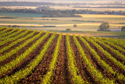
The latest U.S. Drought Monitor report reveals a complex mix of worsening and improving drought conditions across the country. The report, produced by the National Drought Mitigation Center at the University of Nebraska-Lincoln, United States Department of Agriculture and National Oceanic and Atmospheric Administration, highlights the varied impacts of recent weather patterns on different regions.
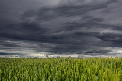
East of the Rockies: Heavy precipitation in parts of the eastern and central U.S. brought some relief, with significant rainfall in areas like the Central Plains. However, high evapotranspiration rates due to excessive heat meant that only regions with at least an inch above normal rainfall saw notable improvements. Areas with below-normal rainfall continued to experience drought degradation.
Northeast: Seasonal temperatures and storm systems brought some relief. Areas with the heaviest rainfall saw improvements, but parts of West Virginia, southern Pennsylvania, and northern Maryland continued to worsen, leading to the introduction of severe drought (D2).
Southeast: Rainfall was inconsistent, and despite heavy rain in some areas, the drought indicators did not show significant improvement. High evapotranspiration rates exacerbated drying trends, leading to continued degradation in many locations.
South: Persistent hot and dry conditions led to expanded drought in most of the region, except for northern Oklahoma and parts of Kansas, which received heavy rainfall. Central and eastern Texas, along with Louisiana, experienced severe drying trends.
Midwest: The Upper Midwest and Great Lakes received substantial rainfall, improving conditions and alleviating flooding in some areas. However, southern parts of Illinois, Indiana, and Ohio saw below-normal rainfall, leading to continued drought.
High Plains: A mix of conditions prevailed, with heavy rain in some areas like Kansas and eastern Nebraska, but below-normal rainfall and above-average temperatures worsened conditions in the western High Plains.
West: Southern regions, including the Four Corners, saw improvements due to moisture influx from low-pressure systems. However, the rest of the West continued to dry out, with worsening drought conditions.
Caribbean and Pacific: Puerto Rico remained drought-free, while the U.S. Virgin Islands experienced scattered showers and remained drought-free overall. In the Pacific, parts of Alaska saw expanded dryness and moderate drought, and Hawaii's stream flows continued to decline due to a lack of meaningful moisture.
Looking ahead: The next five days (July 3-7) are expected to bring hot, potentially record-breaking temperatures to the western U.S., while more seasonal temperatures are forecast east of the Rockies. Heavy rainfall is expected in the Middle and Upper Mississippi Valley, Ohio Valley, Mid-Atlantic, and Southeast. The 6-10 day outlook (July 8-12) predicts above-average temperatures in the Intermountain West and western Plains, with near-normal precipitation expected in the western and north-central U.S. Enhanced precipitation is likely in southern Texas and the western Gulf Coast, with near to below normal temperatures and above-normal precipitation in Alaska and Hawaii.