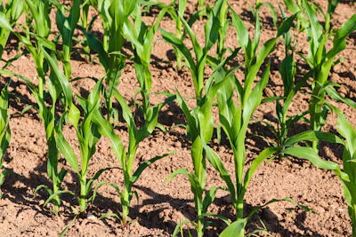
Warm, dry weather is rapidly expanding drought conditions across the Corn Belt and central United States, with the U.S. Drought Monitor reporting worsening dry conditions from Texas through the Mississippi River Valley and into the Midwest, creating significant threats to agriculture and increasing fire danger in affected regions.
- Geographic spread: Flash drought expanding from Texas northward through the Mississippi River Valley and Corn Belt, with significant deterioration in Missouri, Illinois, Kentucky, and west-central Minnesota
- Temperature impact: Much of Minnesota, Iowa, and western Missouri running 2-6 degrees warmer than normal, with Kansas experiencing readings 6-10 degrees above average
- Precipitation deficit: Scattered rainfall mostly under half inch across the region, with long-term precipitation deficits continuing to worsen soil moisture and streamflow conditions
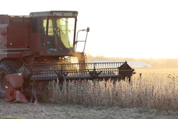
- Agricultural and fire threats: Widespread impacts to agriculture, vegetation damage, and elevated fire danger particularly in southwest Missouri and neighboring Arkansas
- Weather outlook: National Weather Service forecasts continued dry conditions through early September, with warmer-than-normal temperatures favored across central and eastern U.S.
Dry conditions continued to worsen across much of the central United States this week, with flash drought spreading from Texas to the Mississippi River Valley and Corn Belt, according to the latest U.S. Drought Monitor. The U.S. Drought Monitor is produced by the National Drought Mitigation Center at the University of Nebraska-Lincoln, the U.S. Department of Agriculture, the National Oceanic and Atmospheric Administration and NASA.
The combination of warmer- and drier-than-normal weather expanded drought coverage in many areas, with widespread impacts to agriculture and growing fire danger in some regions.
Midwest conditions deteriorate
Dry weather blanketed much of the southern Midwest this week, leading to new or expanded areas of abnormal dryness in Illinois and Kentucky. Conditions degraded significantly in Missouri, especially in south-central and southwest portions of the state.
Fire danger and drought impacts to agriculture and other vegetation continued to worsen in southwest Missouri and neighboring Arkansas. West-central Minnesota also saw worsening drought as short- and long-term precipitation deficits mounted.
Temperatures in the eastern half of the region stayed within 2-4 degrees of normal, while much of Minnesota, Iowa and western Missouri ran 2-6 degrees warmer than normal. Scattered rains fell across parts of the Upper Midwest, locally exceeding 2 inches but mostly depositing a half inch or less.
High Plains see mixed results
A swath of 0.5-2 inches of rain fell from parts of western Nebraska and western Kansas into portions of Colorado and Wyoming. Similar amounts also fell in parts of east-central and northern South Dakota, as well as central and western North Dakota.
Officials re-evaluated the impacts of recent rainfall in southern South Dakota and the Nebraska Sandhills this week, making widespread improvements as soil moisture and streamflow locally improved and short-term rainfall deficits eased.
Scattered improvements also occurred from southern and eastern Wyoming into the western Dakotas and much of eastern Colorado as short-term precipitation deficits improved, along with some gains in soil moisture and streamflow.
However, long-term precipitation deficits and their impacts continued across much of the region, with abnormal dryness and long-term moderate drought remaining. Streamflow stayed low across portions of the western High Plains given poor high elevation snowfall and warm temperatures during the water year.
Temperatures across the region ran hotter than normal, especially in Kansas, where readings mostly ranged from 6-10 degrees above normal. This resulted in high atmospheric demand for moisture in southeast Kansas.
Outlook calls for continued dry weather
The National Weather Service Weather Prediction Center forecasts dry weather to continue across much of the central and south-central U.S. through Monday evening, Sept. 7, especially from southeast Nebraska through Oklahoma, Arkansas and western north Texas.
The Climate Prediction Center’s 6-10 day outlook for Sept. 8-12 favors warmer-than-normal temperatures across much of the central and eastern U.S., with the highest confidence centered around Kansas City and the mid-lower Missouri River Valley. Above-normal precipitation is favored across much of the Great Plains and western U.S., especially from the Continental Divide into the Great Basin and in northern Minnesota.