Drought conditions worsened across much of the eastern United States last week as significant precipitation deficits continued to accumulate, according to the U.S. Drought Monitor report. The U.S. Drought Monitor is produced through a partnership between the National Drought Mitigation Center at the University of Nebraska-Lincoln, the United States Department of Agriculture and the National Oceanic and Atmospheric Administration.
The most severe drought in the Northeast is centered on central Maine and northern portions of Vermont and New Hampshire, where multiple weather stations reported precipitation totals among the driest ever recorded. Barre, Vermont reported the driest three-month period on record with a 6.76-inch deficit, while Berlin, New Hampshire also set a record low and Portland, Maine experienced its third-driest period with a 5.87-inch deficit.
"Widespread degradations were made on the map including expansion of areas of drought in West Virginia, Pennsylvania, New Jersey, New York, Vermont, New Hampshire, and Maine," the report stated.
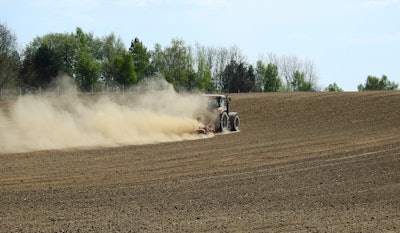
Similar historic conditions affected the Midwest, where Cincinnati and Columbus airports in Ohio both recorded their driest 30-day periods on record with deficits of 2.71 inches and 3.1 inches respectively. Springfield, Illinois reported its second-driest period with a 3.21-inch deficit, while Springfield, Missouri set a record with a 3.45-inch shortfall.
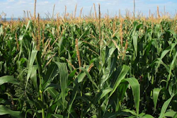
Agricultural impacts mounted across southern Missouri, north-central Kentucky and southern Ohio, according to drought monitoring reports.
In the Pacific Northwest, exceptional drought expanded in the Idaho Panhandle amid declining streamflows and soil moisture levels. Meanwhile, drought conditions improved in parts of the South, with eastern Texas, northern Louisiana, northern Arkansas and central Oklahoma receiving locally heavy rainfall between 2 and 6 inches.
Western reservoir conditions remain mixed, with California's major reservoirs continuing to perform well. Lake Shasta and Lake Oroville stand at 104% and 112% of historical averages, respectively. However, the Colorado River system is at just 38% of capacity, down from 44% at the same time last year, with Lake Powell at 29% full and Lake Mead at 31%.
The forecast calls for moderate to heavy rainfall across southeastern Arizona from Hurricane Lorena remnants and in southern Florida. Most of the country faces above-normal temperatures in the coming week, with the greatest warming expected in the West, Central and Northern Plains.