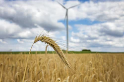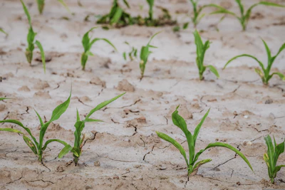
Severe drought conditions have spread across the Midwest and High Plains, with northern Wisconsin, Minnesota, and the Dakotas experiencing some of the worst dry spells in recent memory, causing significant damage to crops and rangelands across the region.
- Affected regions: Northern Wisconsin, Minnesota, the Dakotas, and High Plains states experiencing record-breaking drought conditions with temperatures 6-9 degrees above normal
- Precipitation crisis: Most locations recorded less than 25% of normal precipitation over the past 30 days, with many areas receiving only a few tenths of an inch
- Crop damage: North Dakota reports 53% of sorghum and 40% of corn in poor or very poor condition, far exceeding five-year averages of 13% and 15%
- Rangeland impact: Wyoming shows 75% of pastures in poor condition versus 38% five-year average; Colorado at 64% versus 23% average
- Limited relief ahead: Moderate to heavy rain expected over central and northern High Plains, but northern Great Lakes and Minnesota forecast light precipitation at best
Severe drought conditions continue to spread across the Midwest and High Plains, with northern Wisconsin, Minnesota and the Dakotas experiencing some of the worst dry spells in recent memory, according to the latest U.S. Drought Monitor. The U.S. Drought Monitor is produced by the National Drought Mitigation Center at the University of Nebraska-Lincoln, the U.S. Department of Agriculture, the National Oceanic and Atmospheric Administration and NASA.
The past week brought little relief to parched farmland and struggling ranchers across the region. Most locations in a band from north-central Minnesota through northern Wisconsin recorded less than 25% of normal precipitation over the past 30 days, with many areas reporting just a few tenths of an inch during that period.
Northern tier states hit hardest
Severe drought now covers large sections of northern Wisconsin, much of central and northern Minnesota, and smaller areas of southwestern Minnesota and interior west-central Iowa. The situation has worsened in recent weeks as temperatures averaged 6 to 9 degrees above normal across the western Dakotas and adjacent High Plains.
The dry conditions are taking a serious toll on agriculture. In North Dakota, 53% of sorghum and 40% of corn are in poor or very poor condition, compared to five-year averages of 13% and 15%, respectively. The numbers are similarly grim across other states in the region.
High Plains face mounting challenges
The High Plains region saw some limited relief in eastern Kansas and adjacent Nebraska, where moderate to heavy rainfall provided temporary respite. But the improvements were restricted to small sections of north-central and southeastern Nebraska, while dryness and drought persisted or intensified elsewhere.
Areas from south-central through northeastern Colorado, southernmost and northwestern through north-central Kansas, northeastern Nebraska, and the northern half of the Dakotas saw the most widespread deterioration. Over the past 30 days, most locations outside the highest elevations of Wyoming and Colorado have recorded well below normal precipitation, with less than 25% of normal amounts in central and southwestern Kansas and much of North Dakota.
Large sections of Colorado and Wyoming are now enduring severe to exceptional drought, with the worst conditions affecting significant portions of Colorado and a few patches in western Nebraska. In the Great Plains, severe or extreme drought extends across much of Nebraska and some adjacent areas, the central and western Dakotas, and a few patches in southeastern South Dakota and southwestern Kansas.
Crops and rangelands suffer
The dryness is hitting surface moisture stores hard, with reduced streamflows and degraded crops reported across the region. In Colorado, 64% of pastures and rangelands are in poor or very poor condition, compared to a five-year average of 23%. Nebraska reports 70% of pastures and rangelands in similar condition, against a five-year average of 30%. Wyoming’s numbers are even worse, with 75% in poor or very poor condition compared to a 38% five-year average.
Several crops in Colorado show significant damage, including 46% of corn in poor or very poor condition (five-year average 15%) and 57% of sorghum (five-year average 8%).
Some bright spots emerge
Not all news was bad across the Midwest. A swath of heavier rainfall brought improvement to significant locations across south-central and northern Missouri, central and eastern Iowa, and the southern tier of the Great Lakes region. These areas saw 30-day totals well above normal, creating a patchwork of varying drought severities through the region.
Central and eastern Indiana, along with much of Ohio, received more than 2 inches of rain, with localized areas recording 5 to 7 inches. These totals helped ease conditions in parts of the southern Great Lakes region.
Looking ahead
Forecasters expect moderate to heavy rain over the next several days across the central and northern High Plains, the northern Rockies, and much of a band from central Iowa into western Indiana. The highest totals of 3 inches or more are expected across part of east-central Montana, the northeastern quarter of Colorado, and the Iowa-to-Indiana corridor.
However, light precipitation at best is anticipated across northern portions of the Great Lakes and Minnesota, which could allow drought conditions to persist or worsen in those already hard-hit areas.