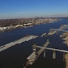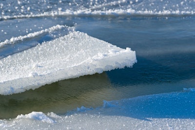
On February 21, the U.S. Army Corps of Engineers, St. Paul District, began taking this year's Lake Pepin ice measurements, which are used to predict the opening of the Upper Mississippi River. Lake Pepin, located between Red Wing and Wabasha, MN, is the last part of the navigation channel for the ice to break up because of its slower river currents.
The navigation season begins when vessels pass through Lake Pepin and arrive in St. Paul, MN. Historically, the opening date of the navigation season occurs during the third week of March. Last year, the beginning of the navigation season was on March 9, when milder February temperatures and less ice accumulation allowed an early passage through Lake Pepin.
At this time, no estimates are available for the opening of the 2018 navigation season on the Upper Mississippi River.