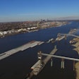
Heavy rainfall, from the middle to lower Mississippi River Valley eastward across much of the Ohio River Basin, has resulted in widespread river flooding along Cincinnati, Cairo, Memphis, and other locations.
High water has caused navigation disruptions on sections of the Ohio, Illinois, Tennessee, and Arkansas Rivers. In response, the Army Corps of Engineers (Corps) closed the Markland Locks, McAlpine Locks, and Smithland Locks.
In addition, large volumes of water from the aforementioned rivers are flowing into the Mississippi River and causing its lower portion to reach flood stage at multiple locations. Barge tow sizes have been reduced from 40 to 30 barges on the lower Mississippi River, and will likely be restricted for several weeks.
Barge traffic is also restricted to daylight passage at Vicksburg and Memphis. River restrictions are set by the Waterway Action Plan, a joint effort of the U.S. Coast Guard, Corps, and senior leaders of the towing industry


